
The Banstead Image Library
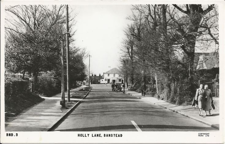
Holly Lane/Bolters Lane, Banstead


Holly Lane, Banstead according to postcard but see below . . .
(date estimated)
Picture added on 01 May 2015 at 11:30
This picture is in the following groups
Roads (all)
Roads (all)
External Links
Banstead History
Banstead History
I have half a dozen maps or street plans of Banstead, one dated 1948, and they all show Bolters Lane (and in some cases Bolter's Lane) ending, and Holly Lane beginning, at the crossroads junction of Garratts Lane and Court Road.
One way to clear any lingering confusion would, of course, be to check the Electoral Register.
One way to clear any lingering confusion would, of course, be to check the Electoral Register.
Added by Peter Denton on 12 April 2020
Banstead




Note from LNW: Yes Mike, you are correct. The road sign which the ladies are about to pass (out of shot) does indeed say Bolters Lane as does Google Earth. Unfortunately the road number at this point seems to be the B2219 which goes from the roundabout at the end of the High Street right down Holly Lane. Bolters Lane is the B2217. I think that confusion over this location has been around for a long time as I am pretty sure that I have a similar postcard in my collection titled something like " A charming bit of Banstead" which neatly sidesteps the whole issue!